Customer Journey swisstopo
All of Switzerland in the Cloud
"It's thanks to Camptocamp that we got the idea in the first place."
It‘s not without a certain irony that swisstopo was the first federal authority to take the step into the cloud: the Federal Office of Topography swisstopo is one of the oldest administrations of all. Its predecessor, the Federal Topographical Bureau, was founded as early as 1838 - ten years before the federal state. Since the creation of the topographic map at the scale of 1:100,000, the country has been surveyed with increasing accuracy and thematic diversity over the decades - and the volume of data at swisstopo has grown larger and larger. By 2008, the data volume had already grown to several terabytes. The geodata intended for publication was hosted on five blade servers in the computer centre of the Federal Office of Information Technology and Communications (FOITT). Then came the request from SchweizMobil, the association for non-motorised traffic, that would change everything.
An impossible task
„SchweizMobil wanted to create a portal on the basis of our data,“ says Hanspeter Christ, Head of Geoinformatics at swisstopo. The tricky part of the job: the release date was already set - and was impossible for swisstopo to meet. „In these three months we would not even have been able to get the servers delivered, let alone install them,“ says Christ. But fate was in our favor: SchweizMobil had commissioned Camptocamp, an IT company from Lausanne that has been advising swisstopo for years, to develop the portal. „The CEO of Camptocamp suggested that the additionally required infrastructure should be provided temporarily via a cloud,“ says Christ. At the time, the authorities would not have come up with this idea on their own, but the proposal fell on fertile ground. „Thanks to the support of Camptocamp, we found a suitable solution. Part of it was managed by the existing servers in the BIT, the additional capacity needed was provided by an AWS cloud,“ says Christ. On April 23rd 2008 - as planned - schweizmobil.ch went live.

The advantages of Open Source
The launch was a complete success, and it didn‘t take long before the superiority of the cloud became apparent. „There were significantly fewer failures in the cloud than in the federal data center,“ says Christ. Based on the positive experience, SchweizMobil decided in 2010 to run the second version entirely in the cloud.
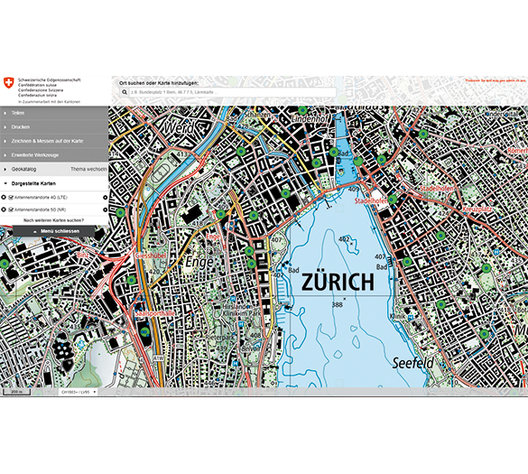
At swisstopo, this decision had a signal effect. „Over the next few years, we have migrated our publishing infrastructure completely into the AWS cloud,“ says Christ. The great advantage of open source also became obvious: „We were able to take over the core of SchweizMobil, which Camptocamp played a major role in developing, for our geoportal“. We were also able to count on the support of the open source community for numerous further developments. Today, swisstopo‘s service offering would hardly be possible without the cloud. This is because the average monthly data transfer to customers has grown to over 50 terabytes. In peak months, this figure has now risen to over 80, but mainly because swisstopo‘s server load varies greatly according to season: In autumn, demand is almost twice as high as in February. Without the stability and flexibility of the cloud, this would be an expensive undertaking.
Agile cooperation
What has also changed and adapted over the years is the cooperation with Camptocamp. It has not only become closer, but increasingly more agile. Whereas swisstopo used to be mainly responsible for project organization and controlling, leaving everything technical to Camptocamp, Christ and his team have increasingly developed their own technical know-how. Today, the two companies are in contact almost every day, and there are monthly meetings where they exchange ideas.
swisstopo
The Federal Office of Topography swisstopo ensures reliable and sustainable documentation of the landscape and the subsoil. It coordinates geoinformation at federal level and with the cantons, has overall control of the official cadastral survey, manages the Military Geographic Institute and operates the federal geoportal with the map viewer map.geo.admin.ch.

Products Infrastructure

Contact us to start your personal success story!
Career
Interested in working in an inspiring environment and joining our motivated and multicultural teams?
- Senior Infrastructure Engineer (m/f/d) - Zurich/Olten
- ERP Consultant Odoo Smartcamp (m/f/d) - France
- IT Project Manager (m/f/d) - Zurich/Olten
- GIS Technical Consultant (m/f/d) - Zurich/Olten
- ERP Consultant Odoo Smartcamp (m/f/d) - Zurich/Olten
- Odoo Developer Internship (m/f/d) - Chambéry
- Odoo Developer (m/f/d) - Olten/Zurich/Munich
- ERP Project Manager (m/f/d) - France


