Lowering the barrier to entry into SDI - Metadata has to be fun!

François Van Der Biest
How do you convince users to put data into a Spatial Data Infrastructure if they have to spend their precious time filling obscure metadata fields?
At Camptocamp, we tried to make data and metadata collection easier for busy people: drag and drop geodata, check everything is correct, answer a few easy questions, and voilà!
The datafeeder is a slick new application, made with Spring Boot and Angular. It is fully integrated into the geOrchestra SDI, thus interacts with GeoNetwork and GeoServer through their APIs.
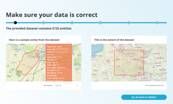
As soon as it is uploaded, data is analysed: format, spatial reference system, bounding box, number of features, encoding...


At this step, the user may fix a bad encoding or an issue with the SRS with an immediate visual feedback.
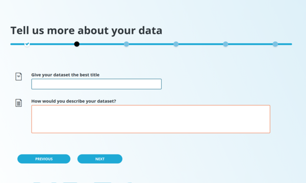
The wizard’s next screens are for basic metadata like dataset title, description, tags, date, scale and lineage.
One may say this is very little information for an ISO metadata … how are the other fields filled?
Well, basically, we use a metadata template, which is overloaded with information coming from:
- The submission process itself, like for the metadata creation date
- The connected SDI user and the organization it belongs to (contact information)
- The wizard form values
- Automatically extracted data from the dataset (bounding box, spatial reference system, etc)
Once the collection process is over, data is pushed to a PostGreSQL / PostGIS database, while a GeoServer layer and an ISO metadata record in GeoNetwork are created.

To keep things tidy and well organized:
- data is pushed to a PostGreSQL schema (which is created on the fly if it does not exist before), named by the user’s organization
- the geoserver layer belongs to a workspace named similarly
- the ISO metadata is created in a geonetwork group also named by the publishing organization.
We’d like to add more features to this core, once we get funding for them:
- being able to upload more formats, like GeoPackage, GeoJSON, … even data without “spatial”. Raster data would be awesome too !
- setting data and metadata diffusion rights - they currently inherit rules already defined for their workspace / group.
- updating metadata using the same UI, rather than in GeoNetwork
- And many more !
The datafeeder is currently released with geOrchestra under the terms of the GPL v3 license. This development not only contributes to the geOrchestra project, but also to the GeoNetwork project, since most of the components were contributed back to the geonetwork-ui library. It also allowed us to contribute a geoserver java REST client to the GeoServer community. We’d like to warmly thank the Haute-Loire French department for sponsoring the initial work.
We’d love to have your feedback!
Please get in touch with us if you have any questions.
Career
Interested in working in an inspiring environment and joining our motivated and multicultural teams?
- Senior Infrastructure Engineer (m/f/d) - Zurich/Olten
- ERP Consultant Odoo Smartcamp (m/f/d) - France
- IT Project Manager (m/f/d) - Zurich/Olten
- GIS Technical Consultant (m/f/d) - Zurich/Olten
- ERP Consultant Odoo Smartcamp (m/f/d) - Zurich/Olten
- Odoo Developer Internship (m/f/d) - Chambéry
- Odoo Developer (m/f/d) - Olten/Zurich/Munich
- ERP Project Manager (m/f/d) - France


