GetItFixed
an open source tool to manage geospatial tickets.

Yves Jacolin
Camptocamp develops an application to manage requests from citizens to council. The idea for this application emerged in 2019 and is now deployed in some customer infrastructures. It aims to improve exchanges between users and the different services of local authorities, improving their responsiveness and monitoring different types of problems. Requests are archived in a single place, so there is no longer any need to ask people to go in the field with a sheet of paper. This tool does not require the creation of an account, making it easy to adapt!

How does it work?
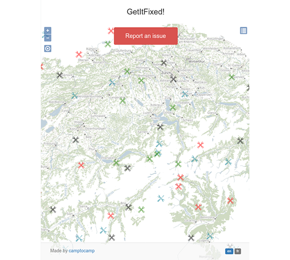
The main interface is based on the location of the inquiries by displaying a map of the requests already uploaded and validated by the service.
The user, who wishes to check whether a request has been made following a problem on the street, can check it quickly and easily. If there is no request for his problem, he can create a new one, the location is taken from the previous screen (map) and a list of categories and types is displayed. Depending on the category, additional information may be displayed on the map allowing the user to be more precise on the location. A description field allows the user to specify his request.
Finally, necessary contact information for follow-up is asked.
New request is created, what next?
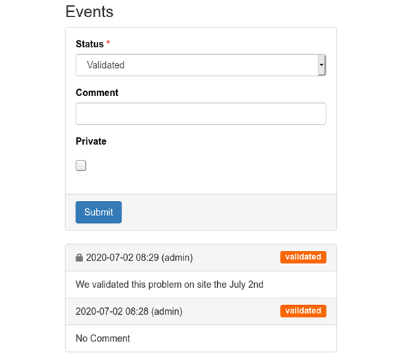
A management team receives an email alert on the new request. A person can process the ticket, with the choice: validate, ask for details, report as duplicate and close it, and of course plan a corrective action.
The manager can contact the requester if he needs to inform him about the progress of the situation, if the ticket is not accurate or if there is a lack of information for example. In case the ticket (or comment) requires discretion, the ticket (or comment) can be made "private" very easily.

But, what if the user is on site?
Mobile has become a reference for developing a public application: they must be compatible on these products above all. The GetItFixed! project therefore focuses on mobile devices. The localization of the request can be done via the user's GPS. Operation is made easy.
And the future?
Many features are awaiting funding (the core of the project is not fully funded either). We want to improve support for large organisms that have to manage different services at different levels for the same type of problem, and depending on the location of the demand. We also wish to develop the analytical part of the project because decision support should be able to bring different viewpoints to show the possibilities of anticipation for the local authorities.
Interested?
If you wish to test the application, our live demo is available here: https://geomapfish-demo.camptocamp.com/getitfixed/getitfixed/issues for the public part
and follow the link for the ticket management part: https://geomapfish-demo.camptocamp.com/getitfixed/getitfixed_admin/issues
We can integrate this project within a GeoMapfish portal or make it independent!
Any ideas? A desire to work with us? Contact us and we will be more than happy to discuss it.
Career
Interested in working in an inspiring environment and joining our motivated and multicultural teams?
- Senior Infrastructure Engineer (m/f/d) - Zurich/Olten
- ERP Consultant Odoo Smartcamp (m/f/d) - France
- IT Project Manager (m/f/d) - Zurich/Olten
- GIS Technical Consultant (m/f/d) - Zurich/Olten
- ERP Consultant Odoo Smartcamp (m/f/d) - Zurich/Olten
- Odoo Developer Internship (m/f/d) - Chambéry
- Odoo Developer (m/f/d) - Olten/Zurich/Munich
- ERP Project Manager (m/f/d) - France


