Vector tiles in GeoMapFish

Yves Bolognini

Services offering geographic data as vector tiles are increasing.
This modern format brings several advantages and is for example already available for many Swisstopo layers.
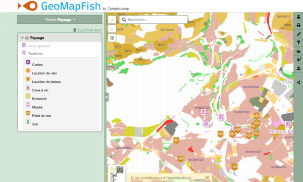
The GeoMapFish solution adapts and provides with its version 2.7 a first implementation of the visualization of vector tiles, while waiting for a complete support.
Vector tiles
Vector tile technology consists in providing the client interface with data represented as vectors. Unlike traditional "raster" tiles, vector tiles can be adapted to the display resolution and allow the implementation of custom styles on the client side. The size of the data files is also much smaller, which has the advantage of limiting loading times and drastically reducing the generation time from raw geographic data. This last point makes it possible to consider, for example, a much more regular update of the tiles.
More and more map data distribution services offer vector tiles and several users of the GeoMapFish solution have shown their interest. A project to add support for vector tiles has therefore been developed. The first developments described below were made possible by an NGDI funding from Swisstopo.
A first step
The available budget does not allow a complete implementation of the vector tile support, so a first step has been identified. The objective was to allow the integration of vector data at all levels of the GeoMapFish solution, from the provision of vector tiles from our own data to the combined visualization with non-vector layers.
The following work has been done in GeoMapFish:
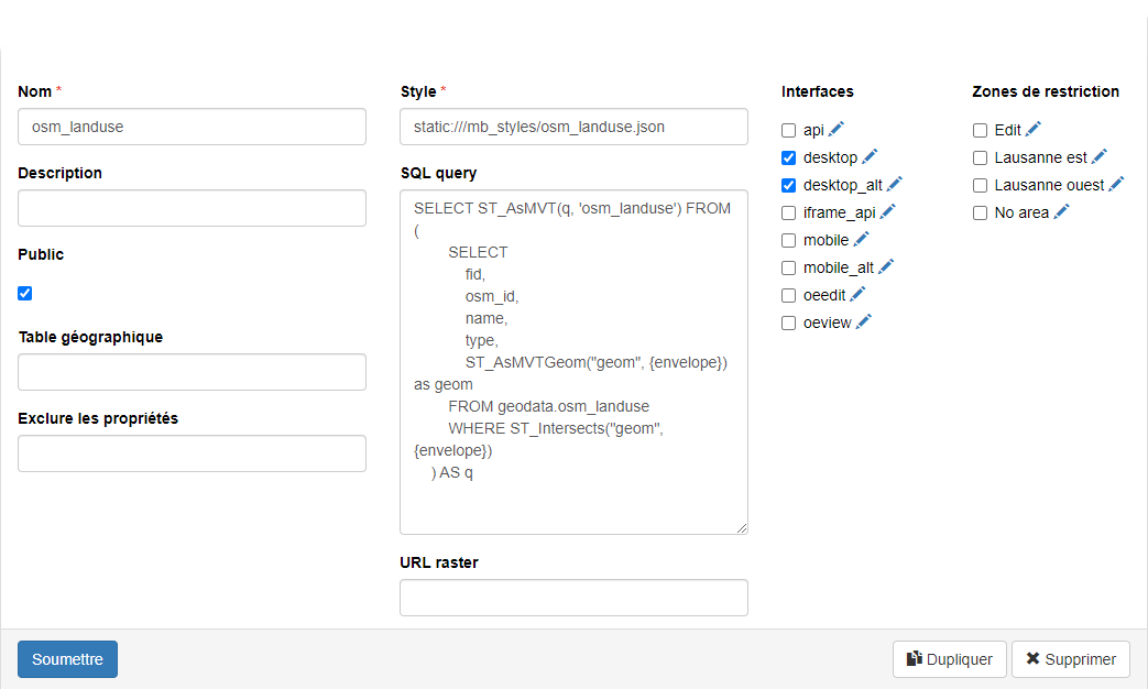
- New layer type for vector tiles, configurable in the administration interface
- Server side view to expose a PostGIS table as vector tiles
- Modification of the background layer selection component to allow the display of a vector layer (OpenLayers layer)

The future
As indicated, the work done is only a first step. In order to complete the support of vector tiles in GeoMapFish, the following work would be required:
- Adaptation of the layer tree to allow the display of vector data as a standard layer (not a background layer)
- Implementation of a solution for querying: vector tile data or WFS fallback
- Implementation of a solution for PDF printing: client or server side rendering
- Improvement of the style management on the server side
- Concept of the client rendering engine (OpenLayers or other)
Get in contact with us!
If you would like to know more about this project, please fill out the form below.
Career
Interested in working in an inspiring environment and joining our motivated and multicultural teams?
- Senior Infrastructure Engineer (m/f/d) - Zurich/Olten
- ERP Consultant Odoo Smartcamp (m/f/d) - France
- IT Project Manager (m/f/d) - Zurich/Olten
- GIS Technical Consultant (m/f/d) - Zurich/Olten
- ERP Consultant Odoo Smartcamp (m/f/d) - Zurich/Olten
- Odoo Developer Internship (m/f/d) - Chambéry
- Odoo Developer (m/f/d) - Olten/Zurich/Munich
- ERP Project Manager (m/f/d) - France


